Original: $14.95
-65%$14.95
$5.23The Story
• Waterproof • Tear-Resistant • Topographic Map
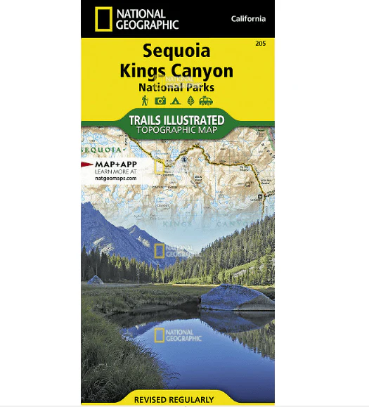
In Sequioa and Kings Canyon National Parks you can walk among the world's largest trees, hike the alpine landscape of the Sierra Crest, and marvel at the towering granite cliffs of one of the deepest canyons in the United States. National Geographic's Trails Illustrated map of Sequoia and Kings Canyon National Parks provides unmatched detail of these parks, meeting the needs of amateur and experienced outdoor enthusiasts alike. Created in partnership with local land management agencies, this expertly researched map features key areas of interest including Sequoia Grove; Giant Sequoia National Monument; John Muir, Golden Trout, Jennie Lakes and Monarch Wilderness Areas; John Muir Trail; Pacific Crest Trail; and Mt. Whitney, the highest peak in the contiguous United States.
With miles of mapped trails in some of the most breathtaking scenery in the entire country, this map can guide you off the beaten path and back again. In addition to detailed and easy-to-read trails, this map includes an accurate road network, campgrounds, scenic overlooks and points of interests, visitor centers and facilities, plus park regulations, backcountry use areas, and contact information for local agencies. The map base includes contour lines and elevations for summits, passes and major lakes.
Every Trails Illustrated map is printed on "Backcountry Tough" waterproof, tear-resistant paper. A full UTM grid is printed on the map to aid with GPS navigation.
Other features found on this map include: Cirque Peak, Golden Trout Wilderness, Inyo National Forest, Jennie Lakes Wilderness, John Muir Wilderness, Kings Canyon National Park, Middle Palisade, Monarch Wilderness, Mount Agassiz, Mount Darwin, Mount Goddard, Mount Kaweah, Mount Langley, Mount Muir, Mount Pinchot, Mount Powell, Mount Russell, Mount Sill, Mount Tyndall, Mount Whitney, Mount Williamson, North Palisade, Sequoia National Forest, Sequoia National Park, Sierra National Forest, Sierra Nevada, Split Mountain, Triple Divide Peak.
Description
• Waterproof • Tear-Resistant • Topographic Map
In Sequioa and Kings Canyon National Parks you can walk among the world's largest trees, hike the alpine landscape of the Sierra Crest, and marvel at the towering granite cliffs of one of the deepest canyons in the United States. National Geographic's Trails Illustrated map of Sequoia and Kings Canyon National Parks provides unmatched detail of these parks, meeting the needs of amateur and experienced outdoor enthusiasts alike. Created in partnership with local land management agencies, this expertly researched map features key areas of interest including Sequoia Grove; Giant Sequoia National Monument; John Muir, Golden Trout, Jennie Lakes and Monarch Wilderness Areas; John Muir Trail; Pacific Crest Trail; and Mt. Whitney, the highest peak in the contiguous United States.
With miles of mapped trails in some of the most breathtaking scenery in the entire country, this map can guide you off the beaten path and back again. In addition to detailed and easy-to-read trails, this map includes an accurate road network, campgrounds, scenic overlooks and points of interests, visitor centers and facilities, plus park regulations, backcountry use areas, and contact information for local agencies. The map base includes contour lines and elevations for summits, passes and major lakes.
Every Trails Illustrated map is printed on "Backcountry Tough" waterproof, tear-resistant paper. A full UTM grid is printed on the map to aid with GPS navigation.
Other features found on this map include: Cirque Peak, Golden Trout Wilderness, Inyo National Forest, Jennie Lakes Wilderness, John Muir Wilderness, Kings Canyon National Park, Middle Palisade, Monarch Wilderness, Mount Agassiz, Mount Darwin, Mount Goddard, Mount Kaweah, Mount Langley, Mount Muir, Mount Pinchot, Mount Powell, Mount Russell, Mount Sill, Mount Tyndall, Mount Whitney, Mount Williamson, North Palisade, Sequoia National Forest, Sequoia National Park, Sierra National Forest, Sierra Nevada, Split Mountain, Triple Divide Peak.